Where Do Chikungunya, Dengue, Yellow Fever, Zika Outbreaks Overlap


Many disease incidence maps offer limited real-time value for international travelers planning trips. Quantifying health risks at the local level is increasingly important to reduce the number of travel-related diseases during the summer of 2025.
Researchers are concerned that surveillance biases hamper existing disease maps and may misrepresent the actual distribution of disease outbreaks.
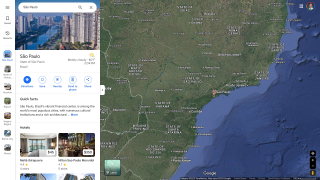
Furthermore, since arboviruses are transmitted mainly by Aedes (Stegomyia) aegypti and Ae. albo-pictus in urban settings, there is an escalating health threat in large population centers that are tourist favorites, such as São Paulo, Brazil, or San Juan, Puerto Rico.
To fill this 'mapping' need for international travelers, the Global Arbovirus Initiative has developed a global framework to monitor the combined risk of Aedes-borne transmission of diseases such as Chikungunya, Dengue, Yellow Fever, and Zika.
Published in the journal Nature on April 10, 2025, researchers address this shortcoming by generating new global environmental suitability maps for Aedes-borne arboviruses using a multi-disease ecological niche model with a nested surveillance model fit to a dataset of over 21,000 occurrence points.
They estimate that 5.66 (95% confidence interval 5.64-5.68) billion people live in areas suitable for dengue, chikungunya, and Zika, and 1.54 (1.53-1.54) billion people for yellow fever.
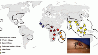
These researchers found substantial geographic overlap between dengue, chikungunya, and Zika occurrence points, with 78.3% (3701/4727) of chikungunya and 83.7% (952/1138) of Zika occurrence points falling within 50 km of a dengue occurrence point This data suggests a high degree of overlap between these different diseases.
The density of points was highest in high-income countries, including the United States, European nations, and Japan, but also in many countries in the Global South, including Brazil, India, and Thailand.
In summary, these researchers wrote, 'This comprehensive assessment of uncertainty serves as a useful starting point for collaboration with researchers and country ministries of health to identify new data sources and targeted data collection activities to validate the suitability maps prospectively.'
'Validation by stakeholders in affected regions will improve the maps and build engagement with them, increasing the likelihood that they can usefully inform surveillance and control policy changes.'
With these enhanced maps, innovative infection screening systems could be deployed at U.S.-based airports to identify international travelers who potentially pose a health risk to local populations.
Previous airport screening programs conducted in the U.S., such as the Traveler-based Genomic Surveillance program and airplane wastewater monitoring, have various implementation limitations, which may obscure where people actually get infected by virus-carrying mosquitoes in 2025.
While the U.S. CDC and other agencies publish travel vaccine recommendations for most countries, these are not targeted to local markets or remote destinations where people vacation. Travelers should speak with vaccine experts at travel clinics or pharmacies to learn about real-time health risks.
Our Trust Standards: Medical Advisory Committee
-
Fact checked by Robert Carlson, MD